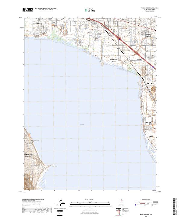
2023 Map of Pelican Point
USGS Topo · Published 2023About this map
Utah Lake dominates the central portion of this survey, defining the western and eastern shores where several of Utah's significant early settlements have grown into a dense suburban corridor. Along the northeastern shoreline, the connected communities of Lehi, American Fork, Pleasant Grove, and Lindon are shown in high detail, illustrating the modern residential expansion that follows the historic path of the state's pioneer-era development. The map traces the water's edge from the northwestern corner at Saratoga Springs down to the distinct geographic features of Jumbers Point, Pelican Point, and Goose Point. In the northeast, the Jordan River Pkwy Trl follows the natural drainage of Spring Creek, while the settlement of Wing sits just north of the American Fork river as it enters the lake.
Find a feature on this map
99 named features on this map. Tap any name to fly to it.
Don’t see what you’re looking for? This feature index may not catch every label — zoom into the map to look around manually.
Map Details
Editions of this 2023 Pelican Point Map
This is the sole edition of this map. No revisions or reprints were ever made.
Other maps of this area

1885 · Salt Lake
USGS Topo · 1:250,000

1948 · Timpanogos Cave
USGS Topo · 1:24,000

1948 · Orem
USGS Topo · 1:24,000

1948 · Orem
USGS Topo · 1:62,500

1948 · Provo
USGS Topo · 1:24,000

1949 · Provo
USGS Topo · 1:62,500

1950 · Orem
USGS Topo · 1:24,000

1950 · Timpanogos Cave
USGS Topo · 1:24,000

1950 · Provo
USGS Topo · 1:24,000
1950 · Soldiers Pass
USGS Topo · 1:24,000