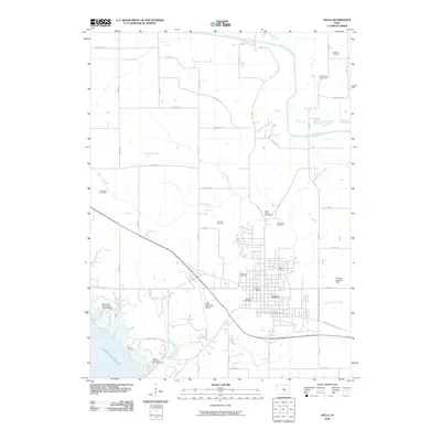
2010 Map of Pella
USGS Topo · Published 2010About this map
Pella serves as the central hub of this Iowa landscape, where the town's grid meets the surrounding agricultural and riparian terrain. The community's local history is well-preserved through numerous burial grounds such as Oak Wood Cemetery, Graceland Cemetery, and the more distant Parsons Cemetery near the South Skunk River. To the southeast, the Lake Red Rock shoreline shapes the topography, supporting recreation at the Wallashuck Campground and North Overlook Campground.
Find a feature on this map
38 named features on this map. Tap any name to fly to it.
Don’t see what you’re looking for? This feature index may not catch every label — zoom into the map to look around manually.
Map Details
Editions of this 2010 Pella Map
This is the sole edition of this map. No revisions or reprints were ever made.
Other maps of this area

1909 · Knoxville
USGS Topo · 1:62,500

1910 · Pella
USGS Topo · 1:62,500

1912 · Knoxville
USGS Topo · 1:62,500

1912 · Pella
USGS Topo · 1:62,500

1954 · Des Moines
USGS Topo · 1:250,000

1956 · Des Moines
USGS Topo · 1:250,000

1957 · Des Moines
USGS Topo · 1:250,000

1965 · Monroe
USGS Topo · 1:24,000
1965 · Otley
USGS Topo · 1:24,000
1965 · Knoxville
USGS Topo · 1:24,000