
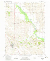
1965 Map of Monroe
USGS Topo · Published 1966About this map
Monroe serves as the primary hub of this mid-1960s Jasper County landscape, where the Chicago Rock Island and Pacific Railroad Grade arcs through the town center toward the South Skunk River. To the north, the river valley is dominated by the Riverview Honor Farm and the forested slopes of Warren Grove. The map records a transition in local infrastructure, with a new highway segment marked under construction bypassng the older grid of Monroe.
Find a feature on this map
33 named features on this map. Tap any name to fly to it.
Don’t see what you’re looking for? This feature index may not catch every label — zoom into the map to look around manually.
Map Details
Editions of this 1965 Monroe Map
2 editions found
Other maps of this area

1909 · Knoxville
USGS Topo · 1:62,500

1910 · Pella
USGS Topo · 1:62,500

1912 · Knoxville
USGS Topo · 1:62,500

1912 · Pella
USGS Topo · 1:62,500

1954 · Des Moines
USGS Topo · 1:250,000

1956 · Des Moines
USGS Topo · 1:250,000

1957 · Des Moines
USGS Topo · 1:250,000

1965 · Prairie City
USGS Topo · 1:24,000

1965 · Newton
USGS Topo · 1:24,000

1965 · Knoxville NW
USGS Topo · 1:24,000