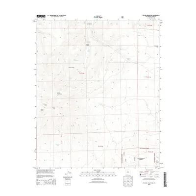
2013 Map of Pelona Mountain
USGS Topo · Published 2013About this map
Pelona Mtn and the high ridges of the Continental Divide dominate this high-altitude landscape in Catron County. Mapping in the early 21st century reveals a topography defined by an intricate network of drainages and named catchments, including Fullerton Spring Canyon and Railroad Canyon. The presence of numerous livestock or wildlife water sources such as Stallings Tank, Cornelius Tank, and the ephemeral Prairie Lake indicates the land's primary utility for grazing and conservation. Within the southern portion of the map, the protected boundaries of the Gila National Forest underscore the transition into more heavily timbered and rugged federal lands. Other significant terrain features include Bear Track Canyon and Juanita Canyon, which illustrate the complex erosion patterns typical of this portion of New Mexico.
Find a feature on this map
24 named features on this map. Tap any name to fly to it.
Don’t see what you’re looking for? This feature index may not catch every label — zoom into the map to look around manually.
Map Details
Editions of this 2013 Pelona Mountain Map
This is the sole edition of this map. No revisions or reprints were ever made.
Other maps of this area

1918 · Pelona
USGS Topo · 1:125,000

1954 · Tularosa
USGS Topo · 1:250,000

1954 · Clifton
USGS Topo · 1:250,000

1957 · Clifton
USGS Topo · 1:250,000

1958 · Clifton
USGS Topo · 1:250,000

1958 · Tularosa
USGS Topo · 1:250,000

1962 · Clifton
USGS Topo · 1:250,000

1979 · San Mateo Mountains
USGS Topo · 1:100,000

1981 · Fullerton
USGS Topo · 1:24,000
1981 · Pelona Mountain
USGS Topo · 1:24,000