
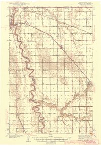
1941 Map of Pembina
USGS Topo · Published 1941About this map
Red River of the North snakes along the international border in this 1930s survey, marking the convergence of North Dakota and Minnesota at the Canadian line. This borderland landscape is defined by a dense network of rural infrastructure, where small settlements like Pembina and St Vincent serve as rail and river hubs. The transition from the flat river valley is punctuated by the Pembina Mountain to the west, while the eastern plains are gridded with drainage ditches and an extensive system of country schools, including Hull Sch and the South Hill Sch.
Find a feature on this map
44 named features on this map. Tap any name to fly to it.
Don’t see what you’re looking for? This feature index may not catch every label — zoom into the map to look around manually.
Map Details
Editions of this 1941 Pembina Map
2 editions found
Other maps of this area

1939 · Drayton
USGS Topo · 1:62,500

1939 · Glasston
USGS Topo · 1:62,500

1939 · Pembina
USGS Topo · 1:62,500

1939 · Kennedy
USGS Topo · 1:62,500

1941 · Kennedy
USGS Topo · 1:62,500

1941 · Drayton
USGS Topo · 1:62,500

1941 · Glasston
USGS Topo · 1:62,500

1941 · Hallock
USGS Topo · 1:62,500

1941 · Bathgate
USGS Topo · 1:62,500

1952 · Thief River Falls
USGS Topo · 1:250,000