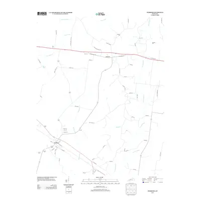
2013 Map of Pembroke
USGS Topo · Published 2013About this map
The community of Pembroke and the historic crossroads of Fairview anchor this Christian County landscape, where the agricultural terrain is defined by the headwaters of the W Fork Red River and Montgomery Cr. The area is notably dense with small family and community burial grounds, including Shanklins Cem, Goshen Cem, and Rosedale Cem, providing a detailed record for genealogical research in this part of Kentucky. Transport routes such as Jefferson Davis Hwy and several school-related roads like Fulcher School Rd suggest a long-established rural infrastructure. The landscape rises toward Keeling Hill in the northeast, while the western portion is shaped by the S Fork Little River and Ewing Lake, illustrating the complex drainage patterns that influenced local land use and settlement.
Find a feature on this map
63 named features on this map. Tap any name to fly to it.
Don’t see what you’re looking for? This feature index may not catch every label — zoom into the map to look around manually.
Map Details
Editions of this 2013 Pembroke Map
This is the sole edition of this map. No revisions or reprints were ever made.
Other maps of this area

1944 · Clarksville
USGS Topo · 1:50,000

1950 · Guthrie
USGS Topo · 1:24,000

1950 · Pembroke
USGS Topo · 1:24,000

1951 · Pembroke
USGS Topo · 1:24,000

1951 · Elkton
USGS Topo · 1:24,000

1951 · Hopkinsville
USGS Topo · 1:24,000

1951 · Hammacksville
USGS Topo · 1:24,000

1951 · Oak Grove
USGS Topo · 1:24,000

1952 · Kelly
USGS Topo · 1:24,000

1952 · Allegre
USGS Topo · 1:24,000