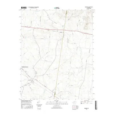
2016 Map of Pembroke
USGS Topo · Published 2016About this map
The agricultural landscape of Christian and Todd counties is defined by the headwaters of several key Kentucky waterways, including the W Fork Red River, S Fork Little River, and Montgomery Cr. The village of Pembroke sits as a primary hub in the south, while Fairview straddles the county line to the north along the historic Jefferson Davis Hwy. Genealogists will find a wealth of burial records preserved in the terrain, with family and community sites such as Shanklins Cem, Goshen Cem, and Rosedale Cem scattered across the rural acreage. The network of country roads, including Old Butler Rd and Vaughns Grove-Little River Rd, reflects a long-standing pattern of farmstead connectivity that persists alongside modern landmarks like Ewing Lake.
Find a feature on this map
56 named features on this map. Tap any name to fly to it.
Don’t see what you’re looking for? This feature index may not catch every label — zoom into the map to look around manually.
Map Details
Editions of this 2016 Pembroke Map
This is the sole edition of this map. No revisions or reprints were ever made.
Other maps of this area

1944 · Clarksville
USGS Topo · 1:50,000

1950 · Guthrie
USGS Topo · 1:24,000

1950 · Pembroke
USGS Topo · 1:24,000

1951 · Pembroke
USGS Topo · 1:24,000

1951 · Elkton
USGS Topo · 1:24,000

1951 · Hopkinsville
USGS Topo · 1:24,000

1951 · Hammacksville
USGS Topo · 1:24,000

1951 · Oak Grove
USGS Topo · 1:24,000

1952 · Kelly
USGS Topo · 1:24,000

1952 · Allegre
USGS Topo · 1:24,000