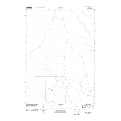
2010 Map of Pence Butte
USGS Topo · Published 2010About this map
Pence Butte dominates the central landscape of this Owyhee County quadrangle, situated in an area of high desert drainage. The 2010 survey delineates the intricate paths of Browns Creek as it winds through the western portion of the map, while Pot Hole Creek flows through the southeastern corner. This region is characterized by sparse transportation infrastructure, primarily defined by the winding route of Pothole Rd. The topographic contours illustrate the subtle but significant elevation changes across the volcanic terrain, capturing the essential geography of the Idaho high desert in the early 21st century. The map serves as a detailed record of water drainage and access routes in this specific corner of the Snake River Plain, providing a clear view of the natural landmarks that define the area's grazing and wilderness character.
Find a feature on this map
4 named features on this map. Tap any name to fly to it.
Don’t see what you’re looking for? This feature index may not catch every label — zoom into the map to look around manually.
Map Details
Editions of this 2010 Pence Butte Map
This is the sole edition of this map. No revisions or reprints were ever made.
Other maps of this area

1947 · Indian Cove
USGS Topo · 1:24,000

1947 · Hammett
USGS Topo · 1:24,000

1947 · Sand Dunes
USGS Topo · 1:24,000

1947 · Hot Spring
USGS Topo · 1:24,000

1948 · Sand Dunes
USGS Topo · 1:24,000

1948 · Hammett
USGS Topo · 1:24,000

1948 · Indian Cove
USGS Topo · 1:24,000

1948 · Indian Cove
USGS Topo · 1:62,500

1948 · Glenns Ferry
USGS Topo · 1:62,500

1948 · Pence Butte
USGS Topo · 1:24,000