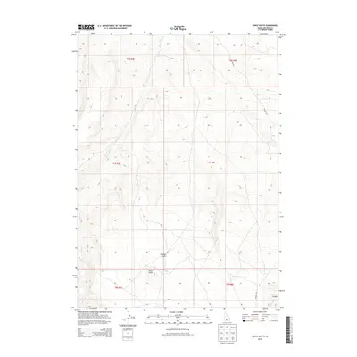
2013 Map of Pence Butte
USGS Topo · Published 2013About this map
Bruneau Desert dominates this corner of Owyhee County, characterized by the expansive arid landscape of southern Idaho. The terrain is punctuated by the volcanic prominence of Pence Butte in the southern reaches of the quadrangle. Drainages like Browns Cr and Pot Hole Cr cut through the high desert floor, eventually leading toward deeper relief such as Pot Hole Canyon. Aside from Pothole Rd, the map shows very few man-made improvements, illustrating the isolated and undeveloped character of the Public Land Survey System townships of T7S and T8S. This 2013 survey provides a clear view of the natural watercourses and topographic contours that define the region's ranching and wilderness history.
Find a feature on this map
12 named features on this map. Tap any name to fly to it.
Don’t see what you’re looking for? This feature index may not catch every label — zoom into the map to look around manually.
Map Details
Editions of this 2013 Pence Butte Map
This is the sole edition of this map. No revisions or reprints were ever made.
Other maps of this area

1947 · Indian Cove
USGS Topo · 1:24,000

1947 · Hammett
USGS Topo · 1:24,000

1947 · Sand Dunes
USGS Topo · 1:24,000

1947 · Hot Spring
USGS Topo · 1:24,000

1948 · Sand Dunes
USGS Topo · 1:24,000

1948 · Hammett
USGS Topo · 1:24,000

1948 · Indian Cove
USGS Topo · 1:24,000

1948 · Indian Cove
USGS Topo · 1:62,500

1948 · Glenns Ferry
USGS Topo · 1:62,500

1948 · Pence Butte
USGS Topo · 1:24,000