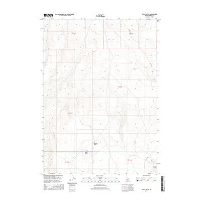
2017 Map of Pence Butte
USGS Topo · Published 2017About this map
The Bruneau Desert landscape of Owyhee County is defined by its wide plateaus and deep drainage incisions as mapped in this 2017 U.S. Geological Survey topographic study. Central to the area is Pence Butte, a prominent landmark that rises above the surrounding flats. The terrain is marked by a network of seasonal watercourses and canyons, including the significant drop at Pot Hole Canyon and the winding path of Pot Hole Cr in the southeast. Sparse transportation routes like Browns Creek Rd and Pothole Rd provide the primary access through this arid environment, following the natural contours of the land. The map meticulously documents the township and range lines across this part of southern Idaho, offering a clear view of the land divisions and topographical features of the high desert plateau.
Find a feature on this map
13 named features on this map. Tap any name to fly to it.
Don’t see what you’re looking for? This feature index may not catch every label — zoom into the map to look around manually.
Map Details
Editions of this 2017 Pence Butte Map
This is the sole edition of this map. No revisions or reprints were ever made.
Other maps of this area

1947 · Indian Cove
USGS Topo · 1:24,000

1947 · Hammett
USGS Topo · 1:24,000

1947 · Sand Dunes
USGS Topo · 1:24,000

1947 · Hot Spring
USGS Topo · 1:24,000

1948 · Sand Dunes
USGS Topo · 1:24,000

1948 · Hammett
USGS Topo · 1:24,000

1948 · Indian Cove
USGS Topo · 1:24,000

1948 · Indian Cove
USGS Topo · 1:62,500

1948 · Glenns Ferry
USGS Topo · 1:62,500

1948 · Pence Butte
USGS Topo · 1:24,000