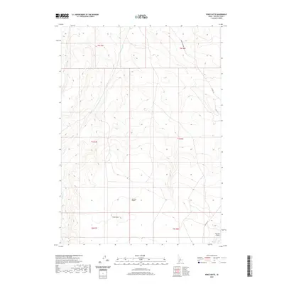
2020 Map of Pence Butte
USGS Topo · Published 2020About this map
Bruneau Desert dominates this section of Owyhee County, characterized by a vast arid expanse where watercourses like Browns Cr and Pot Hole Cr cut through the terrain. The namesake Pence Butte rises as a significant landmark in the southern reaches, providing a high point above the surrounding plateau. The map details a landscape managed by the Bureau of Land Management, showing the intricate grid of Township and Range lines such as t7s r8e that define land division in this part of Idaho. Transportation is limited to a few arterial routes including Browns Creek Rd and Pothole Rd, which follow the natural contours of the land toward Pot Hole Canyon. This survey captures the remote character of the desert environment in the early 21st century, mapping the critical drainage patterns and topographical features essential for navigating this high-desert region.
Find a feature on this map
13 named features on this map. Tap any name to fly to it.
Don’t see what you’re looking for? This feature index may not catch every label — zoom into the map to look around manually.
Map Details
Editions of this 2020 Pence Butte Map
This is the sole edition of this map. No revisions or reprints were ever made.
Other maps of this area

1947 · Indian Cove
USGS Topo · 1:24,000

1947 · Hammett
USGS Topo · 1:24,000

1947 · Sand Dunes
USGS Topo · 1:24,000

1947 · Hot Spring
USGS Topo · 1:24,000

1948 · Sand Dunes
USGS Topo · 1:24,000

1948 · Hammett
USGS Topo · 1:24,000

1948 · Indian Cove
USGS Topo · 1:24,000

1948 · Indian Cove
USGS Topo · 1:62,500

1948 · Glenns Ferry
USGS Topo · 1:62,500

1948 · Pence Butte
USGS Topo · 1:24,000