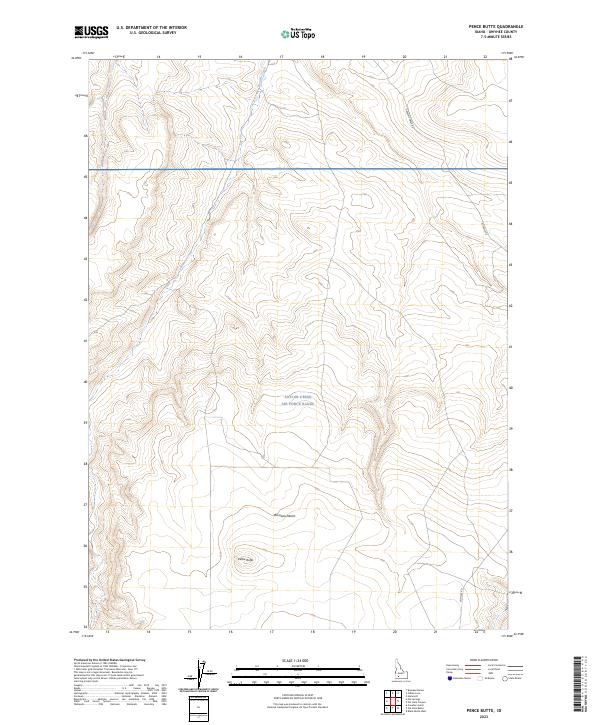
2023 Map of Pence Butte
USGS Topo · Published 2023About this map
Saylor Creek Air Force Range dominates the central portion of this high-desert landscape in Owyhee County. The terrain is characterized by the expansive Bruneau Desert, where the elevation gradually rises toward the prominent landmark of Pence Butte in the southern sections. This modern survey reflects the contemporary utilization of the remote Idaho backcountry, where military range boundaries intersect with traditional desert landmarks. Transportation across this arid environment is limited to a few established routes such as Browns Creek Rd and Pothole Rd, while the ephemeral drainage of Browns Creek provides the primary topographic variation in the northern reaches of the quadrangle.
Find a feature on this map
12 named features on this map. Tap any name to fly to it.
Don’t see what you’re looking for? This feature index may not catch every label — zoom into the map to look around manually.
Map Details
Editions of this 2023 Pence Butte Map
This is the sole edition of this map. No revisions or reprints were ever made.
Other maps of this area

1947 · Indian Cove
USGS Topo · 1:24,000

1947 · Hammett
USGS Topo · 1:24,000

1947 · Sand Dunes
USGS Topo · 1:24,000

1947 · Hot Spring
USGS Topo · 1:24,000

1948 · Sand Dunes
USGS Topo · 1:24,000

1948 · Hammett
USGS Topo · 1:24,000

1948 · Indian Cove
USGS Topo · 1:24,000

1948 · Indian Cove
USGS Topo · 1:62,500

1948 · Glenns Ferry
USGS Topo · 1:62,500

1948 · Pence Butte
USGS Topo · 1:24,000