
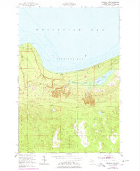
1951 Map of Pendills Lake
USGS Topo · Published 1955About this map
Whitefish Bay and its southern inlet, Pendills Bay, define the shoreline of this mid-century survey along Michigan's Upper Peninsula. The landscape is characterized by the transition from the coastal waters of Lake Superior to the protected woodlands of the Marquette National Forest and Hiawatha National Forest. Small coastal features like Salt Point and Rose Island break the northern coastline, while Lake Shore Drive provides the primary transit route along the sandy banks.
Find a feature on this map
14 named features on this map. Tap any name to fly to it.
Don’t see what you’re looking for? This feature index may not catch every label — zoom into the map to look around manually.
Map Details
Editions of this 1951 Pendills Lake Map
2 editions found
Other maps of this area

1941 · Strongs
USGS Topo · 1:63,360

1941 · Brimley
USGS Topo · 1:63,360

1951 · Strongs
USGS Topo · 1:24,000

1951 · McNearney Lake
USGS Topo · 1:24,000

1951 · Dollar Settlement
USGS Topo · 1:24,000

1951 · Sullivan Creek
USGS Topo · 1:24,000

1951 · Raco
USGS Topo · 1:24,000

1951 · Brimley
USGS Topo · 1:62,500

1951 · Strongs
USGS Topo · 1:62,500

1954 · Sault Sainte Marie
USGS Topo · 1:250,000