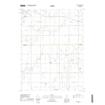
2019 Map of Pendleton
USGS Topo · Published 2019About this map
Pendleton anchors the northwestern corner of this landscape where the boundaries of Madison Co and Hancock Co meet. The area is defined by a dense network of agricultural drainage and small waterways, including the winding Sugar Creek and several engineered channels like Dunwoody Ditch and March and Trees Ditch. This 2019 survey documents a series of small, established rural communities such as Markleville, Warrington, and Willow Branch, reflecting a settlement pattern that has remained consistent over decades. Local history is preserved through several family and community burial grounds, including Bunker Cem, Walker Cem, and Reeves Cem. Aviation interests are represented by the Sauer-Harter Airport in the southern portion of the quadrangle. The map captures the intersection of traditional Indiana farmland with expanding transportation corridors like W State Rd 38 and E State Rd 234.
Find a feature on this map
57 named features on this map. Tap any name to fly to it.
Don’t see what you’re looking for? This feature index may not catch every label — zoom into the map to look around manually.
Map Details
Editions of this 2019 Pendleton Map
This is the sole edition of this map. No revisions or reprints were ever made.
Other maps of this area

1952 · Greenfield
USGS Topo · 1:24,000

1952 · Ingalls
USGS Topo · 1:24,000

1952 · Anderson
USGS Topo · 1:24,000

1953 · Pendleton
USGS Topo · 1:24,000

1953 · Lapel
USGS Topo · 1:24,000

1953 · Cincinnati
USGS Topo · 1:250,000

1953 · Muncie
USGS Topo · 1:250,000

1956 · Muncie
USGS Topo · 1:250,000

1956 · Cleveland
USGS Topo · 1:24,000

1957 · Cincinnati
USGS Topo · 1:250,000