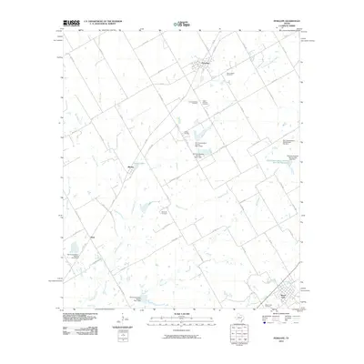
2010 Map of Penelope
USGS Topo · Published 2010About this map
Penelope and the surrounding Hill County countryside are defined by a network of farm-to-market roads and several small settlements that speak to the region's agricultural and ethnic heritage. The presence of the Czech National Cemetery, Saint Joseph Cemetery, and Tabola Cemetery reflects the Central Texas communities that established these rural homesteads. The landscape is crisscrossed by numerous seasonal waterways, including Tehuacana Creek and Wolf Creek, which are managed by a series of Soil Conservation Service dams and reservoirs, such as the Soil Conservation Service Site 92a Reservoir. Further south, the settlement of Mount Calm serves as a local anchor near Packwood Creek. The rural density here remains high for a prairie landscape, with a dense grid of county roads connecting small hamlets like Birome and Hoen to the larger market centers.
Find a feature on this map
61 named features on this map. Tap any name to fly to it.
Don’t see what you’re looking for? This feature index may not catch every label — zoom into the map to look around manually.
Map Details
Editions of this 2010 Penelope Map
This is the sole edition of this map. No revisions or reprints were ever made.
Other maps of this area

1892 · Waco
USGS Topo · 1:125,000

1920 · Waco
USGS Topo · 1:125,000

1920 · Mart
USGS Topo · 1:62,500

1931 · Elm Mott
USGS Topo · 1:62,500

1954 · Waco
USGS Topo · 1:250,000

1955 · Waco
USGS Topo · 1:250,000

1956 · Hubbard
USGS Topo · 1:24,000

1956 · Penelope
USGS Topo · 1:24,000

1956 · Axtell
USGS Topo · 1:24,000

1956 · Abbott
USGS Topo · 1:24,000