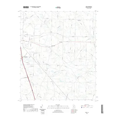
2020 Map of Penia
USGS Topo · Published 2020About this map
The agricultural lands of Crisp County east of Cordele are defined by a network of family-named lakes and rural crossroads in this 2020 survey. Small settlements such as Penia, Listonia, and East Crisp dot the landscape, connected by a grid of named roads like Penia Rd N and Listonia Rd. These communities reflect the long-standing rural structure of the region, where life centers around local landmarks and religious sites.
Find a feature on this map
100 named features on this map. Tap any name to fly to it.
Don’t see what you’re looking for? This feature index may not catch every label — zoom into the map to look around manually.
Map Details
Editions of this 2020 Penia Map
This is the sole edition of this map. No revisions or reprints were ever made.
Other maps of this area

1953 · Waycross
USGS Topo · 1:250,000

1957 · Macon
USGS Topo · 1:250,000

1958 · Macon
USGS Topo · 1:250,000

1958 · Waycross
USGS Topo · 1:250,000

1964 · Macon
USGS Topo · 1:250,000

1971 · Pineview West
USGS Topo · 1:24,000

1971 · Pineview SW
USGS Topo · 1:24,000
1972 · Vienna
USGS Topo · 1:24,000
1974 · Pitts
USGS Topo · 1:24,000

1974 · Amboy
USGS Topo · 1:24,000