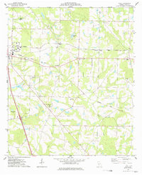
1977 Map of Penia
USGS Topo · Published 1977About this map
Cordele serves as the western anchor for this agricultural landscape, where the Seaboard Coast Line railroad dictates the development of small communities like Penia, Listonia, and East Crisp. The terrain is defined by the drainage of Deep Creek and Lime Creek, which carve through the farmland of Crisp County. This 1970s survey reveals a landscape deeply connected to its local heritage, evidenced by a high density of country churches and family-linked landmarks such as Musselwhite and the Musselwhite Cem.
Find a feature on this map
27 named features on this map. Tap any name to fly to it.
Don’t see what you’re looking for? This feature index may not catch every label — zoom into the map to look around manually.
Map Details
Editions of this 1977 Penia Map
This is the sole edition of this map. No revisions or reprints were ever made.
Other maps of this area

1953 · Waycross
USGS Topo · 1:250,000

1957 · Macon
USGS Topo · 1:250,000

1958 · Macon
USGS Topo · 1:250,000

1958 · Waycross
USGS Topo · 1:250,000

1964 · Macon
USGS Topo · 1:250,000

1971 · Pineview West
USGS Topo · 1:24,000

1971 · Pineview SW
USGS Topo · 1:24,000
1972 · Vienna
USGS Topo · 1:24,000
1974 · Pitts
USGS Topo · 1:24,000

1974 · Amboy
USGS Topo · 1:24,000