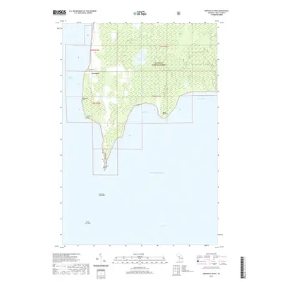
2019 Map of Peninsula Point
USGS Topo · Published 2019About this map
The Stonington Peninsula, a narrow finger of land separating Little Bay de Noc from the broader waters of Lake Michigan, is defined by its maritime isolation and dense woodland. Within the Hiawatha National Forest, the small settlement of Stonington serves as the primary hub of this landscape, situated near the western shore where Lakeview Cem overlooks the water. The geography is punctuated by numerous coastal features, from the sharp turn at Dutchman Point to the sheltered waters of Wilsey Bay. At the southernmost tip of the peninsula, the Peninsula Point Trail leads to Peninsula Point, a critical navigation landmark where the land finally yields to the hazardous Peninsula Point Shoal. Further out in the waters of Green Bay, the Eleven Foot Shoal remains a significant underwater feature for modern maritime traffic.
Find a feature on this map
21 named features on this map. Tap any name to fly to it.
Don’t see what you’re looking for? This feature index may not catch every label — zoom into the map to look around manually.
Map Details
Editions of this 2019 Peninsula Point Map
This is the sole edition of this map. No revisions or reprints were ever made.
Other maps of this area

1932 · Gladstone SE
USGS Topo · 1:31,680

1932 · Rapid River SE
USGS Topo · 1:31,680

1932 · Rapid River SW
USGS Topo · 1:31,680

1954 · Escanaba
USGS Topo · 1:250,000

1957 · Escanaba
USGS Topo · 1:250,000

1958 · Escanaba
USGS Topo · 1:250,000

1958 · Gladstone
USGS Topo · 1:62,500

1958 · Escanaba
USGS Topo · 1:62,500

1958 · Peninsula Point
USGS Topo · 1:62,500
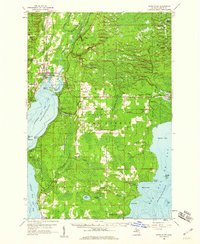
1958 · Rapid River
USGS Topo · 1:62,500