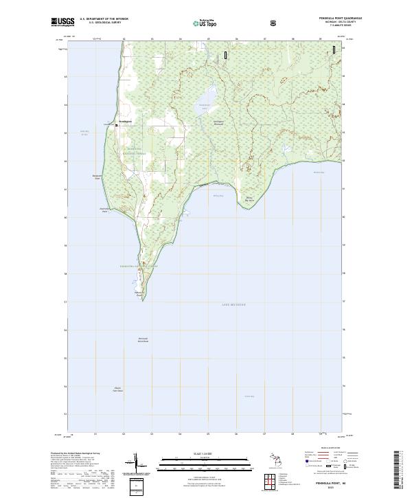
2023 Map of Peninsula Point
USGS Topo · Published 2023About this map
Stonington sits along the western coast of the Stonington Peninsula, looking out over the waters of Little Bay de Noc. This maritime landscape is largely defined by the Hiawatha National Forest, which covers the majority of the landmass. Coastal features like Deepwater Point and Dutchman Point break the shoreline as it narrows toward the south. Near the village, Lakeview Cem serves as a primary genealogical landmark for the local community.
Find a feature on this map
24 named features on this map. Tap any name to fly to it.
Don’t see what you’re looking for? This feature index may not catch every label — zoom into the map to look around manually.
Map Details
Editions of this 2023 Peninsula Point Map
This is the sole edition of this map. No revisions or reprints were ever made.
Other maps of this area

1932 · Gladstone SE
USGS Topo · 1:31,680

1932 · Rapid River SE
USGS Topo · 1:31,680

1932 · Rapid River SW
USGS Topo · 1:31,680

1954 · Escanaba
USGS Topo · 1:250,000

1957 · Escanaba
USGS Topo · 1:250,000

1958 · Escanaba
USGS Topo · 1:250,000

1958 · Gladstone
USGS Topo · 1:62,500

1958 · Escanaba
USGS Topo · 1:62,500

1958 · Peninsula Point
USGS Topo · 1:62,500
1958 · Rapid River
USGS Topo · 1:62,500