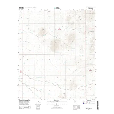
2014 Map of Penitas Hills
USGS Topo · Published 2014About this map
Peñitas Hills and the southern edge of the Sierrita Mountains define this arid landscape in southern Pima County. The terrain is a complex network of seasonal drainages, where the Peñitas Wash, Champurrado Wash, and Papago Wash carve paths through the desert floor. High points such as Baldy Peak and the Black Hills rise above the basin, while Tascuela Canyon cuts through the northern reaches. This 2014 survey documents a landscape focused on water management in an environment where moisture is fleeting. A system of tanks, including the Border Tank, Buddy Tank, and Batamote Tank, are strategically placed to capture runoff from the surrounding slopes. The presence of W Batamote Rd provides one of the few named corridors through this remote reach of the Sonoran Desert.
Find a feature on this map
34 named features on this map. Tap any name to fly to it.
Don’t see what you’re looking for? This feature index may not catch every label — zoom into the map to look around manually.
Map Details
Editions of this 2014 Penitas Hills Map
This is the sole edition of this map. No revisions or reprints were ever made.
Other maps of this area

1920 · Arivaca
USGS Topo · 1:125,000

1925 · Samaniego Peak
USGS Topo · 1:62,500

1939 · Twin Buttes
USGS Topo · 1:62,500

1939 · Tubac
USGS Topo · 1:62,500

1940 · Palo Alto Ranch
USGS Topo · 1:62,500

1941 · Twin Buttes
USGS Topo · 1:62,500

1941 · Arivaca
USGS Topo · 1:62,500

1943 · Arivaca
USGS Topo · 1:62,500

1943 · Palo Alto Ranch
USGS Topo · 1:62,500

1943 · Tubac
USGS Topo · 1:62,500