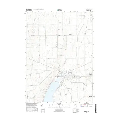
2016 Map of Penn Yan
USGS Topo · Published 2016About this map
Penn Yan sits at the northern tip of Keuka Lake, where the Keuka Lake Outlet begins its eastward descent toward Seneca Lake. This 2016 survey highlights a landscape deeply rooted in its agricultural and industrial heritage, visible in the cluster of mill settlements such as Kenka Mills, Milo Mills, and Seneca Mills along the outlet channel. The village core is dense with history, featuring the Main Street Bridge and several significant burial grounds including Lake View Cem and Saint Michael's Roman Catholic Cem. Moving north into the township of Benton, the terrain transitions to a grid of rural roads and family-named landmarks like Benton Center and the Havens Corners Rd Rural Cem. The map also captures modern infrastructure like the Penn Yan Airport and the geological distinction of the Guyanoga Valley to the west, showing how the region’s topography continues to dictate its development patterns.
Find a feature on this map
89 named features on this map. Tap any name to fly to it.
Don’t see what you’re looking for? This feature index may not catch every label — zoom into the map to look around manually.
Map Details
Editions of this 2016 Penn Yan Map
This is the sole edition of this map. No revisions or reprints were ever made.
Other maps of this area

1902 · Geneva
USGS Topo · 1:62,500

1902 · Phelps
USGS Topo · 1:62,500

1902 · Ovid
USGS Topo · 1:62,500

1903 · Penn Yan
USGS Topo · 1:62,500

1942 · Penn Yan
USGS Topo · 1:31,680

1942 · Pulteney
USGS Topo · 1:31,680

1942 · Rushville
USGS Topo · 1:31,680

1942 · Potter
USGS Topo · 1:31,680

1942 · Stanley
USGS Topo · 1:31,680

1942 · Dundee
USGS Topo · 1:24,000