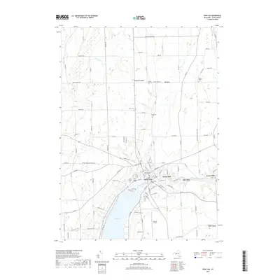
2019 Map of Penn Yan
USGS Topo · Published 2019About this map
Penn Yan serves as the hub of this Yates County landscape, situated at the northern tip of Keuka Lake. The town's civic heart is anchored by the Yates County Courthouse and the Main Street Bridge, which spans the Keuka Lake Outlet. This waterway was historically vital for industry, as evidenced by the string of mill settlements downstream, including Kenka Mills, Milo Mills, and Seneca Mills.
Find a feature on this map
80 named features on this map. Tap any name to fly to it.
Don’t see what you’re looking for? This feature index may not catch every label — zoom into the map to look around manually.
Map Details
Editions of this 2019 Penn Yan Map
This is the sole edition of this map. No revisions or reprints were ever made.
Other maps of this area

1902 · Geneva
USGS Topo · 1:62,500

1902 · Phelps
USGS Topo · 1:62,500

1902 · Ovid
USGS Topo · 1:62,500

1903 · Penn Yan
USGS Topo · 1:62,500

1942 · Penn Yan
USGS Topo · 1:31,680

1942 · Pulteney
USGS Topo · 1:31,680

1942 · Rushville
USGS Topo · 1:31,680

1942 · Potter
USGS Topo · 1:31,680

1942 · Stanley
USGS Topo · 1:31,680

1942 · Dundee
USGS Topo · 1:24,000