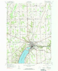
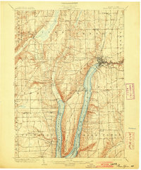
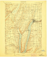
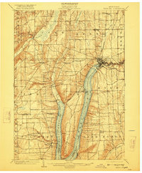
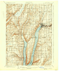
1903 Map of Penn Yan
USGS Topo · Published 1912About this map
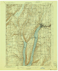
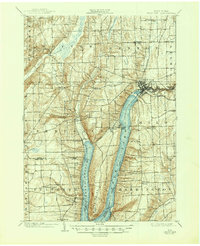
Penn Yan serves as the industrial and transport hub of this Finger Lakes landscape, where the Keuka Lake Outlet flows eastward toward Seneca Mills and Milo Mills. The geography is defined by the distinct Y-shape of Keuka Lake, with Bluff Point rising sharply between the West Branch and the main body of the water. At the turn of the century, the region's economy relied on a sophisticated network of transportation, including the Northern Central R. R. and the Penn Yan and Lake Shore Electric R. R., which connected lakeside settlements like Keuka Park and Branchport. The map details a transition from these bustling rail corridors and mill sites to the upland farming communities of Benton Center and Potter, providing a clear record of the area's rural development and lakeside infrastructure before the mid-century expansion of modern roadways.
Find a feature on this map
51 named features on this map. Tap any name to fly to it.
Don’t see what you’re looking for? This feature index may not catch every label — zoom into the map to look around manually.
Map Details
Editions of this 1903 Penn Yan Map
7 editions found
Historical Maps of Milo Through Time
7 maps found