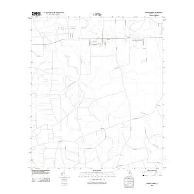
2012 Map of Penney Farms
USGS Topo · Published 2012About this map
Penney Farms serves as the focal point of this Clay County landscape, where early 21st-century residential developments and agricultural roots meet the tributaries of the St. Johns River watershed. The area is defined by the winding paths of S Fork Black Cr and Greens Cr, which carve through the terrain and influence the layout of rural roads such as Batton Bay Rd and Springbank Rd. Family and community history is anchored by Penney Farms Cem and the more southern Salem Cem, providing key points of interest for genealogists tracking local lineages. To the east, Pass Station marks a distinct point of settlement near Peters Cr, while residential streets like Caroline Blvd and Morton Dr indicate the town's more structured grid. This survey provides a clear view of the transition from township blocks to the surrounding timberlands and creek basins.
Find a feature on this map
46 named features on this map. Tap any name to fly to it.
Don’t see what you’re looking for? This feature index may not catch every label — zoom into the map to look around manually.
Map Details
Editions of this 2012 Penney Farms Map
This is the sole edition of this map. No revisions or reprints were ever made.
Other maps of this area

1917 · Orange Park
USGS Topo · 1:62,500

1918 · Middleburg
USGS Topo · 1:62,500

1918 · Orange Park
USGS Topo · 1:62,500

1941 · Middleburg
USGS Topo · 1:62,500

1942 · Ates Creek
USGS Topo · 1:62,500

1947 · Bostwick
USGS Topo · 1:50,000

1948 · Jacksonville
USGS Topo · 1:250,000

1949 · Rice Creek
USGS Topo · 1:24,000

1949 · Bostwick
USGS Topo · 1:24,000

1949 · Middleburg SW
USGS Topo · 1:24,000