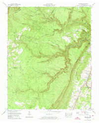
1973 Map of Pennine
USGS Topo · Published 1974About this map
Walden Ridge and the Cumberland Escarpment dominate this Tennessee landscape, where the plateau drops sharply toward the lowlands of the Tennessee Valley. The 1973 survey details a rural economy shaped by this dramatic topography, with the Southern railroad and Highway 27 running along the base of the ridge. Settlements like Spring City and Pennine serve as focal points for the surrounding hills, while higher elevations on the ridge remain largely defined by natural drainage systems like Piney Creek and Little Soak Creek.
Find a feature on this map
68 named features on this map. Tap any name to fly to it.
Don’t see what you’re looking for? This feature index may not catch every label — zoom into the map to look around manually.
Map Details
Editions of this 1973 Pennine Map
2 editions found
Other maps of this area

1887 · Kingston
USGS Topo · 1:125,000

1891 · Kingston
USGS Topo · 1:125,000

1892 · Pikeville
USGS Topo · 1:125,000

1893 · Kingston
USGS Topo · 1:125,000

1895 · Pikeville
USGS Topo · 1:125,000

1909 · Sequatchie Valley
USGS Topo · 1:62,500

1910 · Pikeville
USGS Topo · 1:62,500

1912 · Crossville
USGS Topo · 1:62,500

1935 · Melvine
USGS Topo · 1:24,000

1935 · Morgan Springs
USGS Topo · 1:24,000