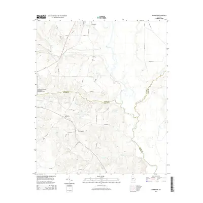
2014 Map of Pennington
USGS Topo · Published 2014About this map
The Flint River carves a winding path through the borderlands of Macon, Sumter, and Dooly counties, anchoring a landscape shaped by rural agricultural history and significant historical memory. Near the western edge of this 2014 survey, the boundary of the Andersonville National Historic Site signifies the area's solemn legacy. The settlement of Pennington serves as a local crossroads, surrounded by numerous small family and community burial grounds, including the Saint James Pennington Cem, Saint Johns Cem, and Norris Cem. To the north, Clearview sits near the headwaters of Goose Cr. The terrain is defined by a network of waterways like Hogcrawl Creek and Mountain Cr that feed into the river valley, while established routes such as Stagecoach Rd and Ga-195 connect these dispersed agricultural communities and historical sites.
Find a feature on this map
46 named features on this map. Tap any name to fly to it.
Don’t see what you’re looking for? This feature index may not catch every label — zoom into the map to look around manually.
Map Details
Editions of this 2014 Pennington Map
This is the sole edition of this map. No revisions or reprints were ever made.
Other maps of this area

1955 · Phenix City
USGS Topo · 1:250,000

1957 · Phenix City
USGS Topo · 1:250,000

1957 · Macon
USGS Topo · 1:250,000

1958 · Macon
USGS Topo · 1:250,000

1958 · Phenix City
USGS Topo · 1:250,000

1964 · Macon
USGS Topo · 1:250,000

1971 · Ideal South
USGS Topo · 1:24,000

1971 · Montezuma
USGS Topo · 1:24,000

1972 · Byromville
USGS Topo · 1:24,000

1972 · Drayton
USGS Topo · 1:24,000