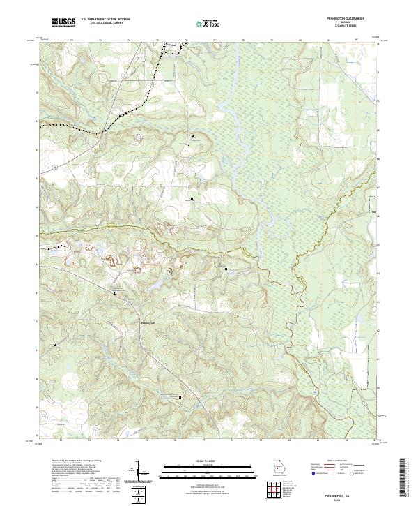
2024 Map of Pennington
USGS Topo · Published 2024About this map
The Flint River carves a winding path through this Georgia landscape, defining the borders between Macon, Sumter, and Dooly counties. The western edge of the map is dominated by the Andersonville National Historic Site, a location of immense significance for Civil War era researchers. The small community of Pennington serves as a local hub, connected by a network of rural routes including Old Stage Rd and Watermelon Rd.
Find a feature on this map
48 named features on this map. Tap any name to fly to it.
Don’t see what you’re looking for? This feature index may not catch every label — zoom into the map to look around manually.
Map Details
Editions of this 2024 Pennington Map
This is the sole edition of this map. No revisions or reprints were ever made.
Other maps of this area

1955 · Phenix City
USGS Topo · 1:250,000

1957 · Phenix City
USGS Topo · 1:250,000

1957 · Macon
USGS Topo · 1:250,000

1958 · Macon
USGS Topo · 1:250,000

1958 · Phenix City
USGS Topo · 1:250,000

1964 · Macon
USGS Topo · 1:250,000

1971 · Ideal South
USGS Topo · 1:24,000

1971 · Montezuma
USGS Topo · 1:24,000

1972 · Byromville
USGS Topo · 1:24,000

1972 · Drayton
USGS Topo · 1:24,000