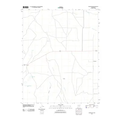
2010 Map of Pennington
USGS Topo · Published 2010About this map
Tramperos Canyon and its seasonal drainage dominate the center of this high plains landscape in northeastern New Mexico. The small settlement of Pennington sits at the junction of County Hwy C-018 and County Rd-C019, serving as a waypoint in an area defined by large-scale ranching operations. The presence of Pasamonte Ranch and landmarks like Pasamonte Lake and Shearing Shed Lake indicate the vital importance of water management in this arid environment.
Find a feature on this map
17 named features on this map. Tap any name to fly to it.
Don’t see what you’re looking for? This feature index may not catch every label — zoom into the map to look around manually.
Map Details
Editions of this 2010 Pennington Map
This is the sole edition of this map. No revisions or reprints were ever made.
Other maps of this area

1954 · Dalhart
USGS Topo · 1:250,000

1958 · Dalhart
USGS Topo · 1:250,000

1962 · Dalhart
USGS Topo · 1:250,000

1973 · Snyder Lake
USGS Topo · 1:24,000

1973 · Tripod Mountain
USGS Topo · 1:24,000

1973 · Garcia Creek
USGS Topo · 1:24,000

1973 · Beenham
USGS Topo · 1:24,000

1973 · Sofia
USGS Topo · 1:24,000

1973 · Romero Spring
USGS Topo · 1:24,000
1973 · Goat Canyon
USGS Topo · 1:24,000