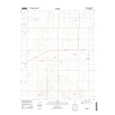
2013 Map of Pennington
USGS Topo · Published 2013About this map
Pennington and the surrounding ranchlands of Union County are defined by a network of seasonal watercourses and springs that have long supported life in this high plains region. The landscape is carved by notable drainages like Tramperos Canyon and Goat Canyon, while isolated water sources such as Foundation Spring and Poison Springs provide vital points of reference in the open country. The presence of the Dempsey Cem and the Pasamonte Ranch suggests a history of generational ranching and early settlement patterns tied to the land's hydrology.
Find a feature on this map
22 named features on this map. Tap any name to fly to it.
Don’t see what you’re looking for? This feature index may not catch every label — zoom into the map to look around manually.
Map Details
Editions of this 2013 Pennington Map
This is the sole edition of this map. No revisions or reprints were ever made.
Other maps of this area

1954 · Dalhart
USGS Topo · 1:250,000

1958 · Dalhart
USGS Topo · 1:250,000

1962 · Dalhart
USGS Topo · 1:250,000

1973 · Snyder Lake
USGS Topo · 1:24,000

1973 · Tripod Mountain
USGS Topo · 1:24,000

1973 · Garcia Creek
USGS Topo · 1:24,000

1973 · Beenham
USGS Topo · 1:24,000

1973 · Sofia
USGS Topo · 1:24,000

1973 · Romero Spring
USGS Topo · 1:24,000
1973 · Goat Canyon
USGS Topo · 1:24,000