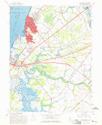
1967 Map of Penns Grove
USGS Topo · Published 1969About this map
Industrial and residential development along the Delaware River defines this late 1960s landscape, centered on the urban core of Penns Grove and Carneys Point. The area's transportation backbone is clearly visible, from the New Jersey Turnpike and the Pennsylvania-Reading Seashore Lines to more localized nodes like Friendship Station. The map illustrates a period of suburban expansion with neighborhoods like Golf Manor and Cedar Crest Manor emerging near established landmarks such as the Sakima Country Club.
Find a feature on this map
72 named features on this map. Tap any name to fly to it.
Don’t see what you’re looking for? This feature index may not catch every label — zoom into the map to look around manually.
Map Details
Editions of this 1967 Penns Grove Map
2 editions found
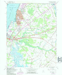
Other maps of this area

1890 · Salem
USGS Topo · 1:62,500

1894 · Chester
USGS Topo · 1:62,500

1896 · Chester
USGS Topo · 1:62,500

1898 · Salem
USGS Topo · 1:62,500

1898 · Chester
USGS Topo · 1:62,500

1901 · Camden
USGS Topo · 1:125,000

1901 · West Chester
USGS Topo · 1:62,500

1904 · West Chester
USGS Topo · 1:62,500

1904 · Wilmington
USGS Topo · 1:62,500

1906 · Wilmington
USGS Topo · 1:62,500