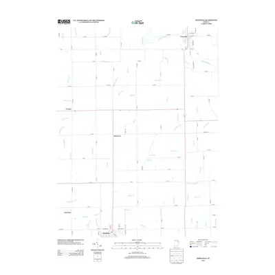
2013 Map of Pennville
USGS Topo · Published 2013About this map
Pennville anchors the northeast corner of this 2013 survey, where its street grid—including Broadway St and E Lagro St—meets the winding course of the Salamonie River. The landscape is a complex network of agricultural drainage and natural waterways, defined by a series of named ditches and runs such as Allman Ditch and Oval Run. This pattern reflects a long-standing engineering tradition in the region, designed to manage the high water table for productive farming.
Find a feature on this map
101 named features on this map. Tap any name to fly to it.
Don’t see what you’re looking for? This feature index may not catch every label — zoom into the map to look around manually.
Map Details
Editions of this 2013 Pennville Map
This is the sole edition of this map. No revisions or reprints were ever made.
Other maps of this area

1953 · Muncie
USGS Topo · 1:250,000

1956 · Muncie
USGS Topo · 1:250,000

1960 · Pennville
USGS Topo · 1:24,000

1960 · Hartford City East
USGS Topo · 1:24,000

1960 · Blaine
USGS Topo · 1:24,000

1960 · Eaton
USGS Topo · 1:24,000

1960 · Ridgeville
USGS Topo · 1:24,000
1960 · Redkey
USGS Topo · 1:24,000

1962 · Montpelier
USGS Topo · 1:24,000

1962 · Petroleum
USGS Topo · 1:24,000