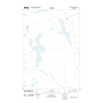
2011 Map of Penobscot Lake
USGS Topo · Published 2011About this map
Penobscot Lake and Long Pond dominate this remote northern landscape near the international border, where water management is defined by structures like the Penobscot Lake Dam and Long Pond Dam. The area is characterized by a dense network of glacial ponds and drainages, including Dole Pond at the northern edge and the complex of Dingley Pond, Upper Dingley Pond, and Little Dingley Pond to the west. Human activity is sparse, marked primarily by the Old Boundary Rd and a handful of local access routes that navigate around features such as Lizzies Bog and the winding Penobscot Brook. This map provides a detailed view of the hydrology and terrain at the boundary of Maine and Quebec in the early twenty-first century, useful for understanding the connectivity of these remote headwaters.
Find a feature on this map
27 named features on this map. Tap any name to fly to it.
Don’t see what you’re looking for? This feature index may not catch every label — zoom into the map to look around manually.
Map Details
Editions of this 2011 Penobscot Lake Map
This is the sole edition of this map. No revisions or reprints were ever made.
Other maps of this area

1927 · Sandy Bay
USGS Topo · 1:48,000

1930 · Sandy Bay
USGS Topo · 1:62,500

1944 · Sandy Bay
USGS Topo · 1:62,500

1949 · Jackman
USGS Topo · 1:250,000

1956 · Penobscot Lake
USGS Topo · 1:62,500

1957 · Norris Brook
USGS Topo · 1:62,500

1957 · Saint Zacharie
USGS Topo · 1:62,500

1962 · Quebec
USGS Topo · 1:250,000

1963 · Jackman
USGS Topo · 1:250,000

1966 · Sherbrooke
USGS Topo · 1:250,000