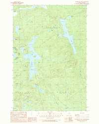
1989 Map of Penobscot Lake
USGS Topo · Published 1989About this map
Penobscot Lake dominates this northern Somerset County landscape, situated along the international border between Maine and Quebec. This 1989 provisional survey captures a remote wilderness defined by a dense network of interconnected waterways, where the Canada-United States border cuts directly through the northern tip of Lac du Portage. The interior reflects an active resource-management landscape, marked by several Gravel Pits and Shale Pits accessed by unimproved roads and trails.
Find a feature on this map
38 named features on this map. Tap any name to fly to it.
Don’t see what you’re looking for? This feature index may not catch every label — zoom into the map to look around manually.
Map Details
Editions of this 1989 Penobscot Lake Map
This is the sole edition of this map. No revisions or reprints were ever made.
Other maps of this area

1927 · Sandy Bay
USGS Topo · 1:48,000

1930 · Sandy Bay
USGS Topo · 1:62,500

1944 · Sandy Bay
USGS Topo · 1:62,500

1949 · Jackman
USGS Topo · 1:250,000

1956 · Penobscot Lake
USGS Topo · 1:62,500

1957 · Norris Brook
USGS Topo · 1:62,500

1957 · Saint Zacharie
USGS Topo · 1:62,500

1962 · Quebec
USGS Topo · 1:250,000

1963 · Jackman
USGS Topo · 1:250,000

1966 · Sherbrooke
USGS Topo · 1:250,000