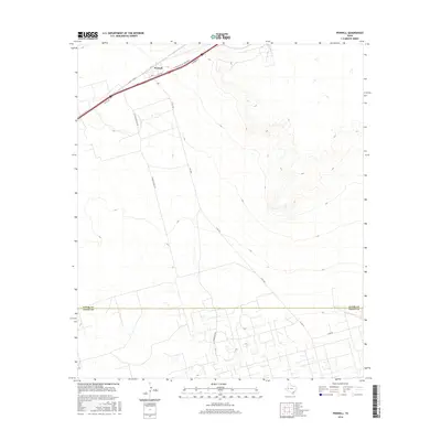
2016 Map of Penwell
USGS Topo · Published 2016About this map
Penwell sits along the northern edge of this West Texas survey, serving as a focal point of infrastructure where W Interstate 20 State Rte N and several arterial roads converge. The settlement is marked by its central Po, and the surrounding landscape is defined by the heavy industrial footprint of the petroleum sector, evidenced by thoroughfares such as S Texaco Plant Rd. The terrain south of the Ector Co and Crane Co boundary reveals a shift in the road network toward more localized routes like Henderson Rd and C Bar Rd. This modern survey provides a clear view of the logistical framework required for the Permian Basin's energy production, illustrating how industrial plants and state highways shape the local geography and dictate the development of small communities in this high-plains environment.
Find a feature on this map
13 named features on this map. Tap any name to fly to it.
Don’t see what you’re looking for? This feature index may not catch every label — zoom into the map to look around manually.
Map Details
Editions of this 2016 Penwell Map
This is the sole edition of this map. No revisions or reprints were ever made.
Other maps of this area

1954 · Pecos
USGS Topo · 1:250,000

1957 · Pecos
USGS Topo · 1:250,000

1964 · Odessa SW
USGS Topo · 1:24,000

1964 · Douro
USGS Topo · 1:24,000

1964 · Metz
USGS Topo · 1:24,000

1964 · Red Lakes
USGS Topo · 1:24,000

1964 · Doodle Bug Well
USGS Topo · 1:24,000

1964 · Penwell SW
USGS Topo · 1:24,000

1964 · Penwell
USGS Topo · 1:24,000

1964 · Penwell SE
USGS Topo · 1:24,000