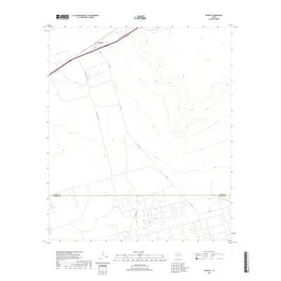
2019 Map of Penwell
USGS Topo · Published 2019About this map
Penwell sits along the northern edge of this West Texas survey, where the infrastructure of the Permian Basin's energy landscape is clearly defined by a network of industrial and service roads. The map documents a transition from the structured residential and service streets of the town, such as W Murphy St and Ave G, to the broad, open expanses of the surrounding oil fields. The terrain is marked by the distinct boundary between Ector Co and Crane Co, with long access routes like S Texaco Plant Rd and S Fm 1601 cutting through the arid landscape to reach isolated sites. Researchers can observe the specialized road network that supports the region's industry, including the I-20 Svc Rd and numerous unnamed tracks that weave through the desert flats and low-lying drainages south toward C Bar Rd.
Find a feature on this map
14 named features on this map. Tap any name to fly to it.
Don’t see what you’re looking for? This feature index may not catch every label — zoom into the map to look around manually.
Map Details
Editions of this 2019 Penwell Map
This is the sole edition of this map. No revisions or reprints were ever made.
Other maps of this area

1954 · Pecos
USGS Topo · 1:250,000

1957 · Pecos
USGS Topo · 1:250,000

1964 · Odessa SW
USGS Topo · 1:24,000

1964 · Douro
USGS Topo · 1:24,000

1964 · Metz
USGS Topo · 1:24,000

1964 · Red Lakes
USGS Topo · 1:24,000

1964 · Doodle Bug Well
USGS Topo · 1:24,000

1964 · Penwell SW
USGS Topo · 1:24,000

1964 · Penwell
USGS Topo · 1:24,000

1964 · Penwell SE
USGS Topo · 1:24,000