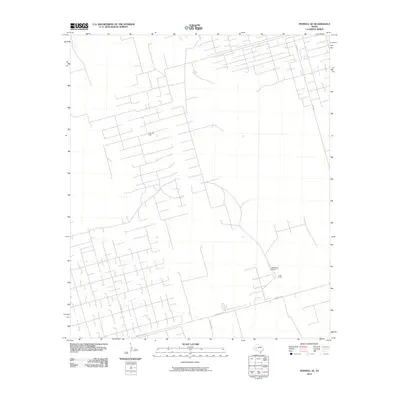
2010 Map of Penwell SE
USGS Topo · Published 2010About this map
The C Bar Oil Field defines this industrial landscape in Crane County, where a dense network of service roads and pipeline corridors crisscrosses the West Texas scrub. This early twenty-first-century survey illustrates the intensive infrastructure required for petroleum extraction, showing how the land has been partitioned for energy production. Amidst this grid of extraction sites, the J Bar Ranch and its associated J-Bar Ranch Airport represent the enduring presence of large-scale ranching operations that often coexist with the oil industry in this region. Access to these remote reaches is provided by a hierarchy of routes, including FM 1601 N and the intersection of Ranch Rd 1233 with several local thoroughfares like Katie Lea Rd and Key Road 10.
Find a feature on this map
8 named features on this map. Tap any name to fly to it.
Don’t see what you’re looking for? This feature index may not catch every label — zoom into the map to look around manually.
Map Details
Editions of this 2010 Penwell SE Map
This is the sole edition of this map. No revisions or reprints were ever made.
Other maps of this area

1928 · Crane
USGS Topo · 1:125,000

1954 · Pecos
USGS Topo · 1:250,000

1957 · Pecos
USGS Topo · 1:250,000

1964 · Metz
USGS Topo · 1:24,000

1964 · Doodle Bug Well
USGS Topo · 1:24,000

1964 · Penwell SW
USGS Topo · 1:24,000

1964 · Penwell
USGS Topo · 1:24,000

1964 · Penwell SE
USGS Topo · 1:24,000

1964 · Clark Brothers Ranch
USGS Topo · 1:24,000

1974 · Tubbs Corner
USGS Topo · 1:24,000