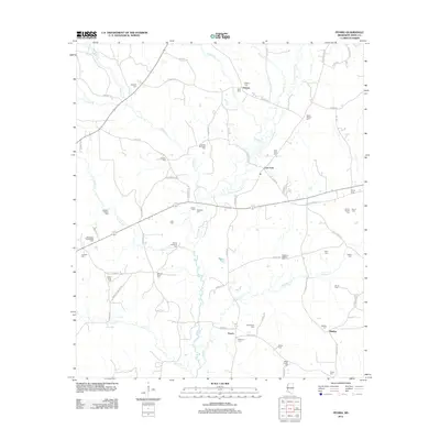
2012 Map of Peoria
USGS Topo · Published 2012About this map
The E Fork Amite River winds through the rural landscape of Amite County, anchoring a region defined by small crossroad settlements and family burial grounds. At East Fork, the river valley converges with several local routes, while the community of Hebron sits to the north, near the confluence of Gordon Cr and Horse Cr. The map is particularly rich for genealogical research, documenting numerous small cemeteries that reflect early family settlement patterns. Notable sites include Mount Sinai Cem, Bates-Felder Cem, and Gardner-McKnight Cem, which are scattered among the timbered tracts and agricultural fields. To the south, the settlement of Peoria and the Glading area are linked by a network of rural roads such as Peoria Rd and Lower Glading Rd, showing the continued importance of these small hubs in the 21st century.
Find a feature on this map
83 named features on this map. Tap any name to fly to it.
Don’t see what you’re looking for? This feature index may not catch every label — zoom into the map to look around manually.
Map Details
Editions of this 2012 Peoria Map
This is the sole edition of this map. No revisions or reprints were ever made.
Other maps of this area

1953 · Natchez
USGS Topo · 1:250,000

1956 · Natchez
USGS Topo · 1:250,000

1959 · Natchez
USGS Topo · 1:250,000

1961 · Liberty
USGS Topo · 1:62,500

1962 · Bude
USGS Topo · 1:62,500

1972 · Smithdale
USGS Topo · 1:24,000

1972 · Auburn
USGS Topo · 1:24,000

1972 · Peoria
USGS Topo · 1:24,000

1972 · Lake Tangipahoa
USGS Topo · 1:24,000
1972 · Gillsburg
USGS Topo · 1:24,000