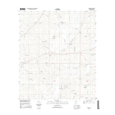
2015 Map of Peoria
USGS Topo · Published 2015About this map
Hebron and Peoria anchor this rural landscape in Amite County, where the network of winding country roads and numerous family cemeteries reveals a deeply rooted community history. The E Fork Amite River and its many tributaries, including Robinson Cr, Gardner Cr, and Hominy Cr, carve through the terrain, dictating the placement of settlements and river crossings. Genealogists will find an exceptional density of family burial sites, from the Nunnery Cem in the north to the Honea Cem near Glading in the south. The prevalence of named landmarks like Webb Chapel and roads such as Dickey Mills Rd and Old MS-24 illustrates the era's local infrastructure and the historical importance of small-scale agriculture and timber in this corner of Mississippi.
Find a feature on this map
83 named features on this map. Tap any name to fly to it.
Don’t see what you’re looking for? This feature index may not catch every label — zoom into the map to look around manually.
Map Details
Editions of this 2015 Peoria Map
This is the sole edition of this map. No revisions or reprints were ever made.
Other maps of this area

1953 · Natchez
USGS Topo · 1:250,000

1956 · Natchez
USGS Topo · 1:250,000

1959 · Natchez
USGS Topo · 1:250,000

1961 · Liberty
USGS Topo · 1:62,500

1962 · Bude
USGS Topo · 1:62,500

1972 · Smithdale
USGS Topo · 1:24,000

1972 · Auburn
USGS Topo · 1:24,000

1972 · Peoria
USGS Topo · 1:24,000

1972 · Lake Tangipahoa
USGS Topo · 1:24,000
1972 · Gillsburg
USGS Topo · 1:24,000