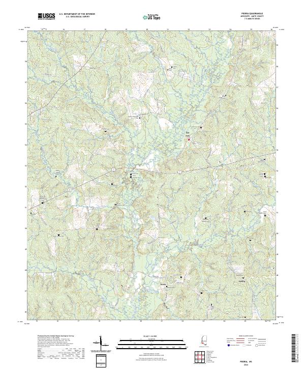
2024 Map of Peoria
USGS Topo · Published 2024About this map
East Fork Amite River winds through the heart of this Amite County landscape, defining the topography between the small settlements of East Fork and Peoria. The region is characterized by its dense distribution of family burial grounds and small community cemeteries, reflecting a deeply rooted rural genealogy. From the Brumfield-Whittington Cem in the west to the Glading Cem near Glading in the east, these landmarks are interconnected by a network of local routes such as Dickey-Mills Rd and Old Peoria Rd. The map illustrates a landscape shaped by water, with numerous tributaries including Hominy Creek, Gardner Creek, and Gordon Creek feeding into the main river system. This rural continuity is further anchored by community sites like Brown Chapel Cem and Webb Chapel Cem, which serve as long-standing markers of local heritage and settlement patterns.
Find a feature on this map
82 named features on this map. Tap any name to fly to it.
Don’t see what you’re looking for? This feature index may not catch every label — zoom into the map to look around manually.
Map Details
Editions of this 2024 Peoria Map
This is the sole edition of this map. No revisions or reprints were ever made.
Other maps of this area

1953 · Natchez
USGS Topo · 1:250,000

1956 · Natchez
USGS Topo · 1:250,000

1959 · Natchez
USGS Topo · 1:250,000

1961 · Liberty
USGS Topo · 1:62,500

1962 · Bude
USGS Topo · 1:62,500

1972 · Smithdale
USGS Topo · 1:24,000

1972 · Auburn
USGS Topo · 1:24,000

1972 · Peoria
USGS Topo · 1:24,000

1972 · Lake Tangipahoa
USGS Topo · 1:24,000
1972 · Gillsburg
USGS Topo · 1:24,000