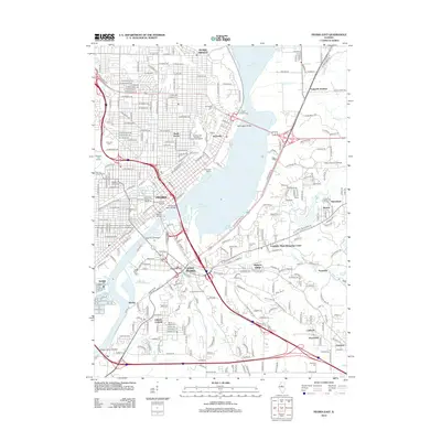
2012 Map of Peoria East
USGS Topo · Published 2012About this map
Upper Peoria Lake and the Illinois River bifurcate this metropolitan landscape, serving as the central axis for the development of Peoria and East Peoria. The 2012 topography reveals a dense urban and suburban grid, including historic areas like Averyville and North Peoria, alongside major institutions such as Bradley University and the University of Illinois College of Medicine. Crossing the water, the Cedar Street Bridge and Bob Michel Bridge link the industrial riverfronts. Significant green spaces and cultural landmarks, including the George Luthy Memorial Botanical Garden and Peoria Mineral Springs, are interspersed with numerous established burial grounds like Springdale Cem and Saint Josephs Cem, providing valuable touchpoints for local genealogists and researchers studying the region's growth.
Find a feature on this map
172 named features on this map. Tap any name to fly to it.
Don’t see what you’re looking for? This feature index may not catch every label — zoom into the map to look around manually.
Map Details
Editions of this 2012 Peoria East Map
This is the sole edition of this map. No revisions or reprints were ever made.
Other maps of this area

1893 · Metamora
USGS Topo · 1:62,500

1893 · Dunlap
USGS Topo · 1:62,500

1898 · Dunlap
USGS Topo · 1:62,500

1905 · Peoria
USGS Topo · 1:62,500

1927 · Peoria
USGS Topo · 1:62,500

1928 · Mackinaw
USGS Topo · 1:62,500

1932 · Mackinaw
USGS Topo · 1:62,500

1932 · Dunlap
USGS Topo · 1:62,500

1933 · Dunlap
USGS Topo · 1:62,500

1937 · Metamora
USGS Topo · 1:62,500