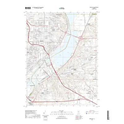
2018 Map of Peoria East
USGS Topo · Published 2018About this map
Upper Peoria Lake and the Illinois River divide this urban landscape, where the industrial and residential growth of central Illinois is documented in fine detail. On the western bluffs, the expansion of Peoria is anchored by Bradley Univ, while across the water, the terrain becomes more varied around East Peoria and the residential pockets of Sunnyland and Highway Village. The map reveals a dense network of local roads such as War Memorial Dr and W Forrest Hill Ave, which serve the established neighborhoods of Peoria Heights and El Vista. To the south, the river corridor supports industrial hubs like Bartonville and Wesley, while the eastern side shows the winding paths of Farm Cr and Dempsey Cr. Several historic resting places, including Fondulac Cem and Saint Joseph's Cem, provide essential data points for local genealogists studying the evolution of these river communities.
Find a feature on this map
232 named features on this map. Tap any name to fly to it.
Don’t see what you’re looking for? This feature index may not catch every label — zoom into the map to look around manually.
Map Details
Editions of this 2018 Peoria East Map
This is the sole edition of this map. No revisions or reprints were ever made.
Other maps of this area

1893 · Metamora
USGS Topo · 1:62,500

1893 · Dunlap
USGS Topo · 1:62,500

1898 · Dunlap
USGS Topo · 1:62,500

1905 · Peoria
USGS Topo · 1:62,500

1927 · Peoria
USGS Topo · 1:62,500

1928 · Mackinaw
USGS Topo · 1:62,500

1932 · Mackinaw
USGS Topo · 1:62,500

1932 · Dunlap
USGS Topo · 1:62,500

1933 · Dunlap
USGS Topo · 1:62,500

1937 · Metamora
USGS Topo · 1:62,500