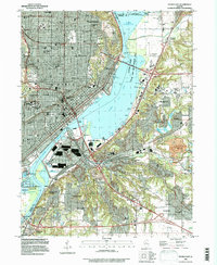
1996 Map of Peoria East
USGS Topo · Published 1997About this map
Upper Peoria Lake and the Illinois River dominate this landscape, serving as the central axis for the dense urban development of Peoria and East Peoria. By the late 1990s, the region shows a sophisticated transportation network of bridges including the Mc Clugage Bridge, Baker Bridge, and Michel Bridge, which link the industrial riverfronts to residential highlands. The map documents an extensive social infrastructure, ranging from the hilltop campus of Bradley University to specialized institutions like the Univ of Illinois Medical Sch.
Find a feature on this map
67 named features on this map. Tap any name to fly to it.
Don’t see what you’re looking for? This feature index may not catch every label — zoom into the map to look around manually.
Map Details
Editions of this 1996 Peoria East Map
This is the sole edition of this map. No revisions or reprints were ever made.
Other maps of this area

1893 · Metamora
USGS Topo · 1:62,500

1893 · Dunlap
USGS Topo · 1:62,500

1898 · Dunlap
USGS Topo · 1:62,500

1905 · Peoria
USGS Topo · 1:62,500

1927 · Peoria
USGS Topo · 1:62,500

1928 · Mackinaw
USGS Topo · 1:62,500

1932 · Mackinaw
USGS Topo · 1:62,500

1932 · Dunlap
USGS Topo · 1:62,500

1933 · Dunlap
USGS Topo · 1:62,500

1937 · Metamora
USGS Topo · 1:62,500