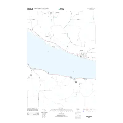
2013 Map of Pepin
USGS Topo · Published 2013About this map
Lake Pepin dominates this riverfront geography, serving as a natural widening of the Mississippi River that separates Wisconsin and Minnesota. Along its northern shores, the village of Pepin and the community of Lakeport are linked by the scenic corridor of Wi-35, while the residential cluster at Pepin Prairie sits just inland. The terrain is defined by a series of dramatic coulees—deep, narrow valleys—including Horse Thief Coulee and Handshaw Coulee, which cut through the bluffs and carry drainage toward the river. Local aviation history is represented by small facilities such as Airwolfe Airport and Bogus Creek Airport. On the Minnesota side, the landscape rises toward Rattlesnake Hill and Maple Springs, where Us-61 follows the base of the bluffs through Dutchman Coulee and Kepler Coulee, illustrating the region's historical reliance on shoreline transportation routes.
Find a feature on this map
75 named features on this map. Tap any name to fly to it.
Don’t see what you’re looking for? This feature index may not catch every label — zoom into the map to look around manually.
Map Details
Editions of this 2013 Pepin Map
This is the sole edition of this map. No revisions or reprints were ever made.
Other maps of this area

1932 · Wabasha
USGS Topo · 1:62,500

1935 · Arkansaw
USGS Topo · 1:48,000

1940 · Maiden Rock
USGS Topo · 1:62,500

1941 · Arkansaw
USGS Topo · 1:62,500

1942 · Arkansaw
USGS Topo · 1:62,500

1950 · Maiden Rock
USGS Topo · 1:62,500

1951 · Wabasha
USGS Topo · 1:62,500

1951 · Lake City
USGS Topo · 1:62,500

1953 · Saint Paul
USGS Topo · 1:250,000

1959 · Saint Paul
USGS Topo · 1:250,000