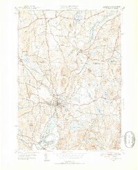
1950 Map of Pepperell
USGS Topo · Published 1952About this map
The Nissitissit River and Nashua River converge in this mid-century portrait of the borderlands between Massachusetts and New Hampshire. The settlement at Pepperell and its neighbor East Pepperell serve as focal points for a landscape defined by small-scale farming and the Boston and Maine railroad, which follows the river valley through the Hollis Depot. Local genealogists will find significant detail in the numerous burial grounds, including the St Joseph Cem and St Louis De Gonzague Cem, reflecting the area's diverse community history.
Find a feature on this map
46 named features on this map. Tap any name to fly to it.
Don’t see what you’re looking for? This feature index may not catch every label — zoom into the map to look around manually.
Map Details
Editions of this 1950 Pepperell Map
4 editions found
Other maps of this area

1886 · Lowell
USGS Topo · 1:62,500

1893 · Lowell
USGS Topo · 1:62,500

1893 · Groton
USGS Topo · 1:62,500

1905 · Manchester
USGS Topo · 1:62,500

1906 · Milford
USGS Topo · 1:62,500

1918 · Lowell
USGS Topo · 1:62,500

1921 · Lowell
USGS Topo · 1:62,500

1931 · Lowell
USGS Topo · 1:48,000

1931 · Groton
USGS Topo · 1:48,000

1935 · Ayer
USGS Topo · 1:24,000