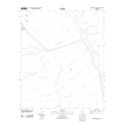
2011 Map of Peppersauce Wash
USGS Topo · Published 2011About this map
The San Pedro River corridor defines this arid Pima County landscape, where water drainage patterns dictate the placement of ranch roads and remote settlements. The industrial presence of San Manuel in the northwest contrasts with the expansive network of alluvial washes, such as Peppersauce Wash and Stratton Wash, that cut through the desert floor. Historical land use is evident in the named ranching access routes like Tom Rhodes Ranch Rd and Yle Ranch Rd, which navigate the terrain between the Little Black Hills and the river valley. The map reveals the intricate intersection of natural geography and modern infrastructure, notably where Black Hills Mine Rd provides transit through the complex canyon systems of Alder Canyon and YLE Canyon.
Find a feature on this map
20 named features on this map. Tap any name to fly to it.
Don’t see what you’re looking for? This feature index may not catch every label — zoom into the map to look around manually.
Map Details
Editions of this 2011 Peppersauce Wash Map
This is the sole edition of this map. No revisions or reprints were ever made.
Other maps of this area

1904 · Tucson
USGS Topo · 1:125,000

1905 · Tucson
USGS Topo · 1:125,000

1911 · Winkelman
USGS Topo · 1:125,000

1913 · Winkelman
USGS Topo · 1:125,000

1938 · Galiuro Mts
USGS Topo · 1:48,000

1943 · Galiuro Mts
USGS Topo · 1:62,500

1945 · Redington
USGS Topo · 1:62,500

1948 · Clark Ranch
USGS Topo · 1:24,000

1948 · Mammoth
USGS Topo · 1:62,500

1948 · Mammoth
USGS Topo · 1:24,000