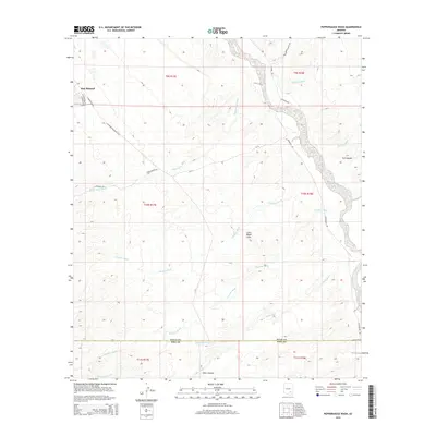
2014 Map of Peppersauce Wash
USGS Topo · Published 2014About this map
San Manuel anchors the northwestern corner of this Arizona landscape, where the developed streets of E Main St and S Veterans Memorial Blvd give way to an intricate system of arid drainage channels. The terrain is defined by several prominent dry washes, including the namesake Peppersauce Wash and the extensive Stratton Wash, which slice through the high desert topography. To the south, the Pinal Co Pima Co boundary line divides the quadrangle, marking a transition toward the deeper recesses of Alder Canyon and the Little Black Hills. Remote tracks like Campo Bonito Rd and S Redington Rd provide the primary access through these canyons, following the natural contours of the land. The mapping of YLE Canyon and Cienega Wash to the east reflects a region shaped by ephemeral water flow and rugged isolation.
Find a feature on this map
24 named features on this map. Tap any name to fly to it.
Don’t see what you’re looking for? This feature index may not catch every label — zoom into the map to look around manually.
Map Details
Editions of this 2014 Peppersauce Wash Map
This is the sole edition of this map. No revisions or reprints were ever made.
Other maps of this area

1904 · Tucson
USGS Topo · 1:125,000

1905 · Tucson
USGS Topo · 1:125,000

1911 · Winkelman
USGS Topo · 1:125,000

1913 · Winkelman
USGS Topo · 1:125,000

1938 · Galiuro Mts
USGS Topo · 1:48,000

1943 · Galiuro Mts
USGS Topo · 1:62,500

1945 · Redington
USGS Topo · 1:62,500

1948 · Clark Ranch
USGS Topo · 1:24,000

1948 · Mammoth
USGS Topo · 1:62,500

1948 · Mammoth
USGS Topo · 1:24,000