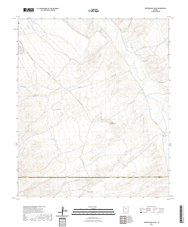
2021 Map of Peppersauce Wash
USGS Topo · Published 2021About this map
The San Pedro River corridor near the Pinal and Pima county line defines this arid landscape in southeastern Arizona. This 2021 survey illustrates a complex network of seasonal drainage systems, including Peppersauce Wash, Stratton Wash, and Alder Wash, which carve through the high desert terrain. The topography is anchored by the Little Black Hills and the deep incision of YLE Canyon, reflecting the intricate geological features of the San Pedro Valley. Local transit and land access are indicated by numerous named tracks and ranch roads, such as Black Hills Mine Rd and Campo Bonito Rd. These routes connect remote areas like the 3C Ranch Rd to larger thoroughfares, highlighting the region's historical and contemporary reliance on ranching and mining infrastructure.
Find a feature on this map
30 named features on this map. Tap any name to fly to it.
Don’t see what you’re looking for? This feature index may not catch every label — zoom into the map to look around manually.
Map Details
Editions of this 2021 Peppersauce Wash Map
This is the sole edition of this map. No revisions or reprints were ever made.
Other maps of this area

1904 · Tucson
USGS Topo · 1:125,000

1905 · Tucson
USGS Topo · 1:125,000

1911 · Winkelman
USGS Topo · 1:125,000

1913 · Winkelman
USGS Topo · 1:125,000

1938 · Galiuro Mts
USGS Topo · 1:48,000

1943 · Galiuro Mts
USGS Topo · 1:62,500

1945 · Redington
USGS Topo · 1:62,500

1948 · Clark Ranch
USGS Topo · 1:24,000

1948 · Mammoth
USGS Topo · 1:62,500

1948 · Mammoth
USGS Topo · 1:24,000