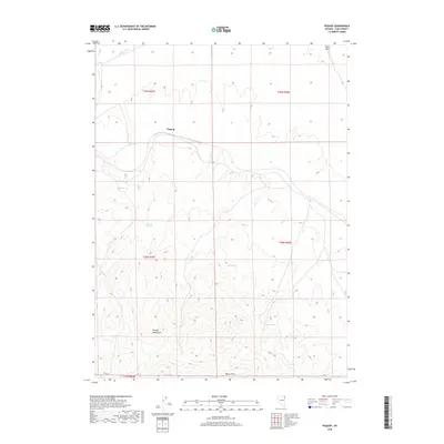
2018 Map of Pequop
USGS Topo · Published 2018About this map
Pequop is situated along a rail corridor that threads through the rugged highlands of northeastern Elko County. This survey highlights a landscape where water sources dictate human and animal movement, with various named seeps like Himmel Springs, Pequop Spring, and Sheep Spring scattered among the slopes. The terrain is dominated by the steep ridges of the Pequop Mountains, which rise sharply toward the south.
Find a feature on this map
15 named features on this map. Tap any name to fly to it.
Don’t see what you’re looking for? This feature index may not catch every label — zoom into the map to look around manually.
Map Details
Editions of this 2018 Pequop Map
This is the sole edition of this map. No revisions or reprints were ever made.
Other maps of this area

1955 · Wells
USGS Topo · 1:250,000

1958 · Wells
USGS Topo · 1:250,000

1961 · Wells
USGS Topo · 1:250,000

1967 · Valley Pass
USGS Topo · 1:24,000

1967 · Ninemile Mtn SW
USGS Topo · 1:24,000

1967 · Cobre
USGS Topo · 1:24,000

1968 · Holborn
USGS Topo · 1:24,000

1968 · Pequop
USGS Topo · 1:24,000
1968 · Pequop Summit SW
USGS Topo · 1:24,000
1968 · Pequop Summit
USGS Topo · 1:24,000