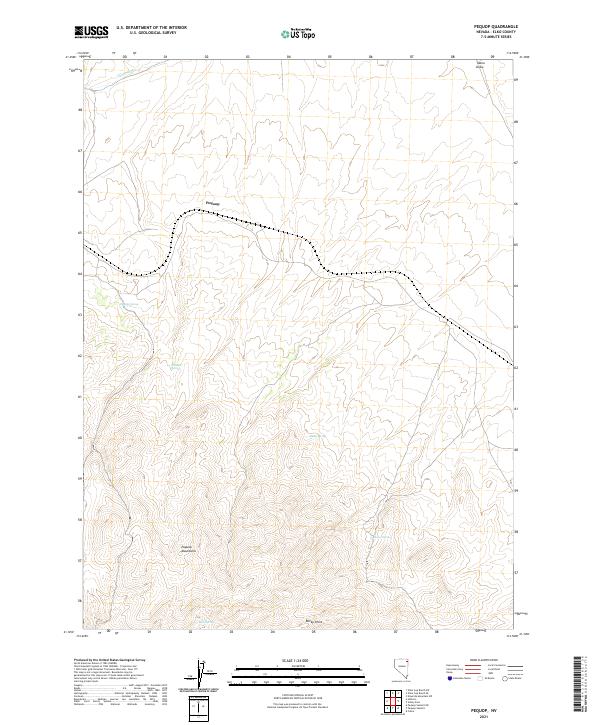
2021 Map of Pequop
USGS Topo · Published 2021About this map
The high-elevation terrain of the Pequop Mountains dominates this portion of Elko County, where the settlement of Pequop sits along a critical transportation corridor. This area reflects a classic Great Basin landscape where water sources are the primary indicators of human and animal activity across the arid stretches. The map identifies several vital water points, including Pequop Spring, Himmel Springs, Sheep Spring, and Baker Spring, which are often the focal points for local history and ranching operations. In the northern reaches, the drainage patterns of Deadman Cr and Toano Draw cut through the foothills. The prominent landmark of Rocky Point stands near the southern boundary, anchoring the topographic survey of this remote mountain range and its scattered springs.
Find a feature on this map
15 named features on this map. Tap any name to fly to it.
Don’t see what you’re looking for? This feature index may not catch every label — zoom into the map to look around manually.
Map Details
Editions of this 2021 Pequop Map
This is the sole edition of this map. No revisions or reprints were ever made.
Other maps of this area

1955 · Wells
USGS Topo · 1:250,000

1958 · Wells
USGS Topo · 1:250,000

1961 · Wells
USGS Topo · 1:250,000

1967 · Valley Pass
USGS Topo · 1:24,000

1967 · Ninemile Mtn SW
USGS Topo · 1:24,000

1967 · Cobre
USGS Topo · 1:24,000

1968 · Holborn
USGS Topo · 1:24,000

1968 · Pequop
USGS Topo · 1:24,000
1968 · Pequop Summit SW
USGS Topo · 1:24,000
1968 · Pequop Summit
USGS Topo · 1:24,000