2014 Map of Pequop Summit SW
USGS Topo · Published 2014About this map
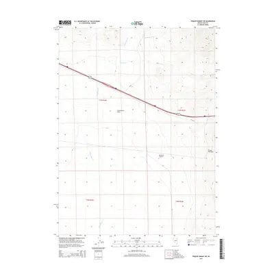
Independence Valley dominates the central landscape of this Elko County region, serving as a broad drainage basin for the surrounding high country. The eastern edge of the map is defined by the steep rises of the Pequop Mountains, where Maverick Canyon carves through the terrain. This area represents a critical high-desert transit corridor, as evidenced by the modern path of Interstate 80 and Alt 93 which cut diagonally across the valley floor. Hydrological patterns are dictated by seasonal drainages, including the northern reach of Barnet Springs Cr and the branching paths of Independence Cr and W Squaw Cr. This 2014 survey documents the intersection of essential infrastructure and natural landmarks, including the Forest Road FR 435 RD, in an area defined by its wide basins and dramatic mountain boundaries.
Find a feature on this map
13 named features on this map. Tap any name to fly to it.
Don’t see what you’re looking for? This feature index may not catch every label — zoom into the map to look around manually.
Map Details
Editions of this 2014 Pequop Summit SW Map
This is the sole edition of this map. No revisions or reprints were ever made.
Other maps of this area

1955 · Wells
USGS Topo · 1:250,000

1955 · Elko
USGS Topo · 1:250,000

1958 · Wells
USGS Topo · 1:250,000

1958 · Elko
USGS Topo · 1:250,000

1961 · Wells
USGS Topo · 1:250,000

1962 · Elko
USGS Topo · 1:250,000

1965 · Elko
USGS Topo · 1:250,000

1968 · Moor Summit
USGS Topo · 1:24,000

1968 · Independence Valley NE
USGS Topo · 1:24,000

1968 · Holborn
USGS Topo · 1:24,000